Archive for the ‘Back South to Goose Bay’ Category

The Dark Tickle

Wednesday, August 25th, 2010
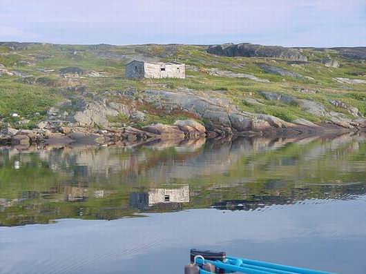
Islands shores littered with abandon homes

Islands shores littered with abandon homes

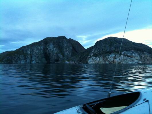
To head toward Lake Melville from Emily Harbor I would have to either go north again and round the whole of the big Brig Harbor Island or pass south of Deadman Island and dare the Dark Tickle. The Dark Tickle is a deep but narrow passage between Butt and Camel Islands. The islands shores are littered with abandoned homes from an era long gone from the lands of Labrador. They add a sense of forlorn loneliness to the stark beauty of this remarkable place. Was the tickle named for these broken dreams on her shore or the darkness of the rocks that bound her waters? Even in the bright sunshine of this morning, there is a darkness here and a trepidation. Still, I choose to dare the Dark Tickle.
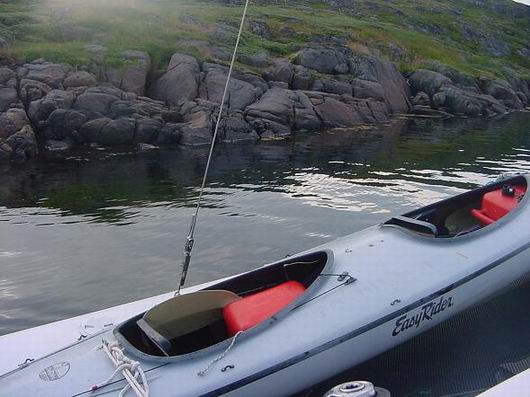
A passage less than half again as wide as the CAP’N LEM

A passage less than half again as wide as the CAP’N LEM

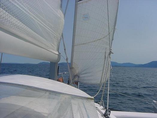
I checked the tidal current by creeping through the channel past Deadman Island. It was near slack. The wind? None. Slowly I turned the CAP’N LEM south around the Camel Island and felt as much as sighted my way toward the north entrance. The rudder is free to kick up, the dagger board is floating in its case ready to rise. Bump! A rock! I’m too close to the shoals of Butt Island. The slow impact merely slides the hull to one side and I reposition more to the west for the run into the tickle. Checking the chart plotter I see it is I and not the rock that is miss positioned and this gives me courage to press on. The little engine is pushing ahead ever so gently at idle and we slip into and out of the passage less than half again as wide as the CAP’N LEM without incident. With each boat length the waters grow deeper into Dark Tickle Harbor and I line up my escape. But not time to relax, there are rocks and shoals a plenty around Double and Thomey Islands and Man Of War Point. The main channel is still ahead. And the wind just started to rise.
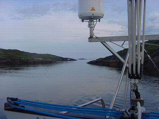
Escape

Escape

NOTES: I define deep water as any water that will float my boat and shallow water as any water that won’t. Bumping a rock at anytime is not to be taken lightly and I made a thorough assessment to be assured there was no damage.
Daring the Dark Tickle

Tuesday, August 24th, 2010

No blog from Tommy today, looks like he’s got the wind so will sail until late.

“One great day! 69 miles so far. Still underway on Lake Melville. Wind at my back for the first time in a long time. Will ride it as long as it blows Thursday wind back on the nose again and I want to be in Goose Bay before then.

Will blog about the Dark Tickle tomorrow. What fun! it was so narrow but went through fine. No wind then. then the wind came up on the quarter and I sailed all the way to the Rigolet Narrows.

All systems go t.”

In honor Tommy letting me sail with him on the way up to Nain last month, here are a few of my favorite images:

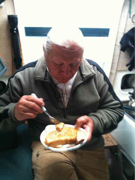
Tommy's makes the world's best French Toast, all in a pan just barely large enough to hold a single piece of bread.

Tommy's makes the worlds best French Toast, all in a pan just barely large enough to hold a single piece of bread. He says the secret is to toast the bread before frying, but I think there is more

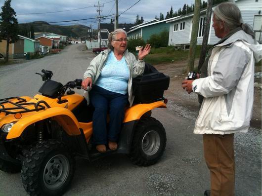
Tommy makes new friends wherever he goes.

Tommy makes new friends wherever he goes. If you have to chance to meet him in person, you'll understand immediately.

A narrow channel just off the north edge of Western Kingitok Island.

A narrow channel just off the north edge of Western Kingitok Island. This moment of calm belies many hidden dangers; wind, rock, tides, and cold. Without the decades of experience Tommy has amassed, I would never have been blessed with such a view. Thank you Tommy.

Tuchialic Bay to Emily Harbor

Monday, August 23rd, 2010

2100 Position Report August 23, 2010

Anchored in 41 feet of water at Emily Harbor, Brig Harbor Island, Labrador. Lat. 54° 32′ 36.9″ N ~ Lon. 057° 11′ 07.6 W

It was a long run out from Tuchialic Harbor to Cape Harrison with no wind to help the little engine that could only to come around the Cape to a head wind from the south east. That’s just the way it was. I set sail due east out to sea to gain room to tack south. But the way things are, are not always how they stay, and the wind did backed enough to the east that I could tack and make some progress to the south. I fought the urge to tack back out off the coast and threaded my way through shoals and rocks. They were well charted and easily spotted by the breaking swells washing over them. Then, when I needed it most, half way between Cape Harrison and Cape Rouge the wind changed again and this time to the south giving the lift to clear Cape Rouge and run for Emily Harbor on Brig Harbor Island making 7 to 8 kts steady and some spurts even higher. It was a 13 hour day from anchorage to anchorage filled with everything from motoring in calm to some fine white-knuckle sailing. Then the last five miles into the anchorage, it was right back on the bow at 20 kts in some tight quarters. I give up, and motor in at 3 kts. Whee, what a day.

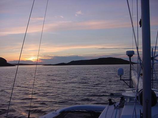
Sunset at Emily Harbor

Sunset at Emily Harbor

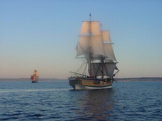
Being anchored at Brig Harbor Island brings to mind once again all the fine people aboard the Brig LADY WASHINGTON. A ship of dreams, she is for sure! Many people come on board her as crew to find their lives are changed for ever. Mine certainly was. Many of the crew members on my four month tenure as mate have become life long friends. Some of then, I haven’t seen again, but know when I do, it will be a joyous reunion. Tall Ships are like that. Once crew, always crew.

When I meet sailors working on other vessels like the ISSUMA or WANDERBIRD, I try to encourage them with “sometime, when you’re ready and looking for a ship, go sail on the LADY!” I’m not trying to steal any ones crew, mind ya, just sowing seeds of thought for latter. There were some good sailors on both those vessels when I met them in Nain and I’d love for them to show up on the LADY WASHINGTON someday and say “Capt. Tommy sent me.”

Tomorrow, I start to make my way inland again.

BRIG LADY WASHINGTON

BRIG LADY WASHINGTON

Departing Makkovik

Sunday, August 22nd, 2010

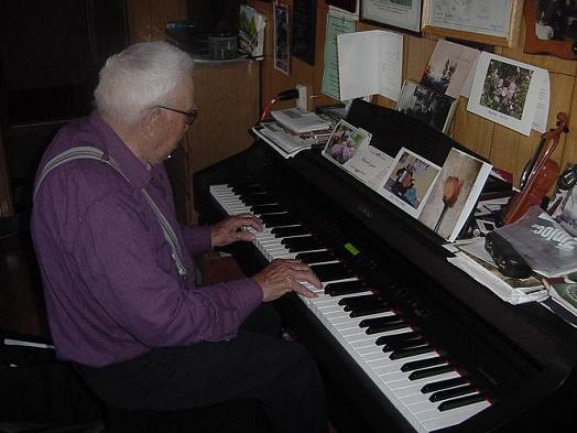
I stopped by Uncle Jim’s to say a last farewell before catching the brisk breeze coming down the harbor. He had told me of the time he and his brother snow shoed to Goose Bay from Makkovik to work and how it had taken nine days to get there. But only 4 days to get back because, then, they were heading for home. I was able to tell him the story of my last days with Captain Lem and how far we traveled together before he wore out and died. Uncle Jim played me a farewell song on the organ, “Every Day With Jesus”. We shook hands and promised to meet again.

91 years old, those hands, and still making music.

91 years old, those hands, and still making music.

The CAP’N LEM fairs better at anchor than at a dock and I had to get underway for lack of fendering against the wind pushing against the pilings. It made for a much more comfortable night. Tonight would be the same so I got underway to be a little farther down my track.

Coming out of Makkovik Bay the wind backed and strengthened such no real headway was going to be made so I turned in to Ford’s Bight to seek anchorage. I found my anchorage at the end of the bay in 45 feet of water and 30 knots of wind! (Lat. 55° 04′ 28″ N ~ Lon 059° 06′ 16″ W) It was a good mud bottom so we just rode it out. Looking out the hatch to check the position yet one more time, I saw a minke whale surfaced not far away. The wind died with the sun.

The forecast called for more of the same strong south east wind, right where I wanted to go! But Sunday morning brought a gift wind more from the south and just strong enough to allow me to round the lesser cape, Cape Strawberry and track into the islands I wanted to see. How could I pass up going by Pretty Harbor Island on my way to Tuchialic Bay?

Always an Island on the Bow

Always an Island on the Bow

The day truly was a gift of some of the nicest sailing in a long time. The afternoon wind did back to the south east at a gentle 12 to 15 knots and CAP’N LEM clipped along at 7.5 to 8 knots with the windward amma airborne most of the time. We crossed paths with feeding dolphin twice. I could tell they were feeding because of the birds that followed them to fight for leftovers.
I find my refuge surrounded by high mountains on all sides save the entrance and even the entrance is guarded by islands. I anchor in 60 feet of water at Lat. 54° 45′ 07.2″N ~ Lon 058° 25′ 49.7″ W. Unlike Uncle Jim and his brother on their way home, I’m in no hurry for this wonderful adventure to end.

Cape Makkovik

Friday, August 20th, 2010

The day broke calm after a night of chasing false anchor alarms. In such tight quarters in Peter’s Cove I dare not set the alarm at any greater distance than 150 ft. A 180° swing on the anchor would set it off and I get up, look around, and go back to sleep. It’s just what I have to do. So up with the anchor and out to round the twin capes of Cape Aillik and Cape Makkovik.

The sunrise calm was short lived. Coming out of the lee of Cape Aillik the CAP’N LEM struggled up and down the face of a lone steep swell coming from the direction of Greenland. Something was happening way up north and far out at sea. I’m thankful to be heading south. It’s interesting that Cape Makkovik and Cape Horn are at about the same Latitudes of opposite signs North and South. This morning I feel like it may as well be Cape Horn.

Cape Makkovik

Cape Makkovik

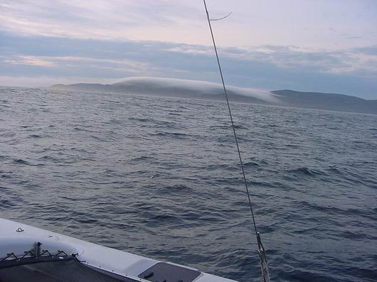
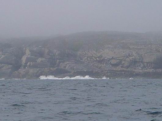
To the east, a long cold finger of fog wags a warning from an evil looking hand gripping the top of the Cape. “Be prepared, ye who dare this way, this day. Be prepared!” I turn on my fickle little Furuno and after a very long 60 second stand-by while the internals warm up, I press the transmit key. Yes, it found its heading signal. All is well. My mind runs through my back up plans. Should the little engine die can I claw my way off the lee shore at this range and run down wind out of danger. Yes, the wind is building slowly but at an angle which will allow me escape from the crashing surf on the hard rocks. No more than now is the mile in front of me more important. On the GPS the track crosses the old track around the Capes from the trip north. I give them even more room this morning. Slowly my north east track veers to east, to south east, to near south and I’m around with the swell on the quarter and a clear run into Makkovik Bay. The wind backs to the northeast and pushes the fog up and over the mountain. I run out the headsail and enter the Bay in style.

Breakers

Breakers

Within minutes of docking, “Uncle Jim” Andersen, is there to greet me. “Have you seen Wanderbird? How far did you go? Come by to see me.” Were it not for one more chance to visit this most interesting man, I might have kept right on going.

Peter’s Cove

Thursday, August 19th, 2010

Anchored in Peter’s Cove on the Cape Makkovik Peninsula in 28 feet of water Lat. 55° 12′ 18.2″ N ~ Lon 059° 15′ 07.6″ W.

Departed Hopedale at 1000 in calm wind and clear sky. By noon the winds picked up to easterly at 15 knots then rose steadily to 20. I threaded my way through many small islands to find the wind nearly on the nose. I was able to make some progress by short tacking several times but the going was slow and tiring. I didn’t have it in me to beat around the headlands so started to search for a suitable anchorage. That’s when I found Peter’s Cove. Peter was a man of good taste! The rock formations are fascinating. Many broken into squares. Peter could have built a castle here and never gone more than a half mile for stones.

One of the great delights of sailing Labrador is the pristine anchorages. Many show no signs humans ever were here. Where can you find that anywhere else. Always a beer can and polypropylene line washed up in a corner of the coves I’ve visited most.

But Labrador is not without its problems. The remoteness of the towns and villages lend to alcohol and drug abuse. Other factors of unemployment and isolation contribute to a high suicide rate among young people. Each community has told me of some recent tragedy. Heartbreaking. Pray for these dear people, please. They are so kind and hospitable toward travelers. I think it’s in their nature.

Peters Cove

Peters Cove

Windy Tickle to Hopedale

Wednesday, August 18th, 2010
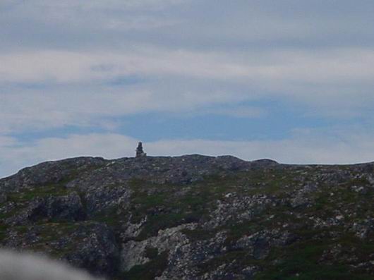
Hopedale Inukshuk

Hopedale Inukshuk

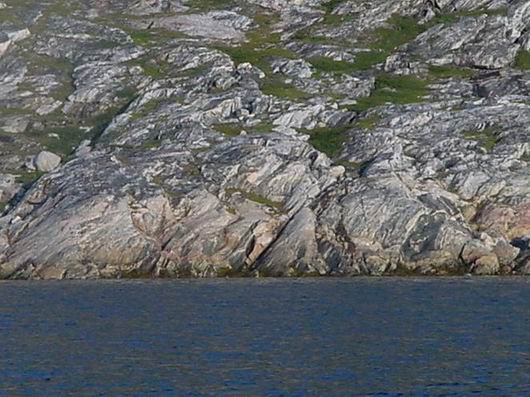
The predawn wind was freshening from the Southwest. I was up early to catch what ever of the south flowing current I could in the Windy Tickle thinking I would be bucking a headwind. But the Windy Tickle was not as windy as my anchorage and I came out the south end to just enough room to short tack and catches a lift from the southwester to make good progress toward Hopedale. The stratification of the rock cliffs of the Tickle was so interesting. They sang of the tortured geological past in their color and design. I passed through much too quickly.

windy-tickle-001resized

The CAP’N LEM is starting to crisscross the old northbound track I’ve saved on the GPS Plotter screen. When given a choice of two courses I try to choose the route not taken for the chance of seeing something new. There’s a lot of new to be seen on Labrador Coast.

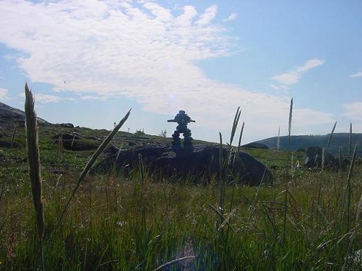
The wind allowed me to make considerable headway with only a few short tacks to clear this shoal and that island headland such that I arrived in Hopedale just after noon. Inukshuk gave me a silent welcome from the hills over Hopedale. The public dock was clear and allowed me an easy landing.

The wind is predicted to back to the east Thursday and give me the lift I need to make way toward Makkovik. I wonder if Uncle Jim will be waiting on the pier.

Shoal Tickle

Monday, August 16th, 2010

August 16, 2010 Position Report

Anchored at 55° 45′ 46.1″ N ~ 060° 21′ 33.1″ W in 24 feet of water having just transited the Shoal Tickle between Nunaksaluk Island and the mainland. Its charted depth was 4′ but I never saw less than 7 feet below the keel. You can bet I went through at a dead slow with the dagger board and rudder floating free should I contact the bottom. It saved me miles of beating against a head wind.

The day was a sunny and warm day with no wind until late in the afternoon which made for a good run to the tickle once I cleared the islands south of Nain. The bay is large but well protected and, of course, just beautiful.

Another Day Hunting the Moonstone

Sunday, August 15th, 2010

The early sun woke me to a still water and cloudless sky. The silhouette of Tabor Island against the coming dawn was breathtaking. (I got the name from a fisherman passing. It was not what I thought it was.) How could I just up the anchor and sail away from such opportunity. I could not. It will be a long time before I pass this way again. Oh, I do hope I will pass this way again.

Having found some Labradorite, I now know what to look for. The Encarta on my computer tells me it is also know as Moonstone when blue and Sunstone when orange and yellow. So once again I launch the Gray Ghost and head to shore. No sign of the resident black bear, but he could be just over the rise. I take my air horn and running shoes.

I walk up to the quarry to see it I can find any chips from the blasting but the ground is covered with a low brushy growth of some sort of red berries. This must be what the bear was eating. If it is these things, he’s got plenty to eat on Tabor Island. I find berries but no Labradorite so back down the hill I go to the spot I found it yesterday.

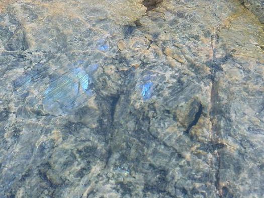
This morning in the bright sunlight…it is everywhere! And it is stunningly beautiful! But mostly it is in boulders and the rock face of the hill at the waters edge. I even start to find it in smaller pieces that I can pick up. It takes a lot of will power to leave behind some of the bigger rocks sparkling blue like a peacock feather but I’ve already picked up enough to weigh down the kayak. So I just paddle around in awe of this gift of nature and her cleverness at hiding it so far away.

just below the water

just below the water

I’ve never painted my name on a rock or a wall in my life. But in Labrador there is something the Inuit did to report their passing among the islands and I can’t resist. I build an Inukshuk looking out on the bay where the CAP’N LEM is anchored. The winter wind and the heaving frost will turn it back into the pile of rocks it once was, but for just this season it is my monument to this place and its people I have grown to love so much. It simply says someone was here and when he left then went that direction.

more-labrodorite-hunting-005resized

By noon the tide turns and it’s time. Boats are made to move and sailors to move them. Up the anchor and away around the island that has given me so much. I don’t see the bear but I hope he is still there.  After traveling for 6 hours with the outgoing tide and no wind, the little engine that could brings me to anchorage at 56° 12′ 35.2″ N ~ 061° 21′ 04.2″ W in 28 feet of water. I’ll spend a restful night in this place. It is large and well protected. I will sleep the sleep of one who has had one of the best days of his life. In Labrador, that’s just about every day.

Searching for Labradorite

Saturday, August 14th, 2010

1900 Position Report August 14, 2010

Anchored at 56° 24′ 14.7″ N ~ 061° 48′ 21.3″ W in 31feet of water.

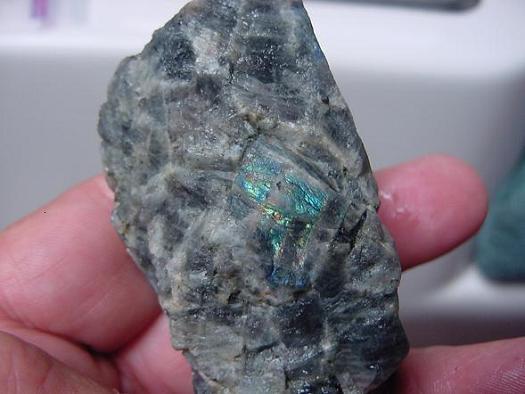
I departed Nain at 1000 to start a slow leisurely trip to Hopedale. I was given directions to an abandon quarry on a small island who’s name I can not pronounce let alone spell to search for Labradorite. It’s also known as moonstone. Friends had given me a piece of it when in here on the way north. It truly is a beautiful stone with colors that remind me of a peacock feather.

Of course there was a bear on the hillside and I watched him make his way around the area I most wanted to go and then over the hill. It was a solitary male from what I could tell. I waited an hour before launching the Gray Ghost and paddling ashore armed with my trusty air horn and running shoes. Had it been a sow with cubs, no way! But from the skittishness of the black bears I saw on the way down form Port Manvers, I felt safe enough. The island is near treeless and I could see a long way in either direction.

First I walked the water line hoping to see it shining up just below the surface but found none that way. The first piece I found glistened an iridescent blue in the warm afternoon sun. Only thing is it was a part of a large bolder and is safe from a rock picker like me for at least another million years. But this gave me encouragement to keep looking and at the base of a large hill I indeed did find some in rock a little easer to handle. I would like to have spent longer in search of the lovely stuff, but enough time had past for the bear to have made a round of the island and air horn or not, I had just as soon be in the kayak heading out when he returned.

Labradorite

Labradorite

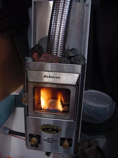
Not being one for collecting a lot of souvenirs, I’m very happy with these and other little treasures I’ve picked up. They are decorating my Cozy Fireplace both inside the firebox and out. Inside, they help hold the heat from the flame and glow a warm red like coals in burning wood. On top, the rocks help dispense the heat in to the cabin.

Cozy

Cozy

The wind is not in my favor tomorrow so I don’t expect to make much to the south. The thousands of islands are so pleasant to travel through I’ll ride the morning tide as long as I can before finding yet another anchorage and wait out the afternoon wind.