Archive for July, 2009

Waiting

Friday, July 31st, 2009

cannery
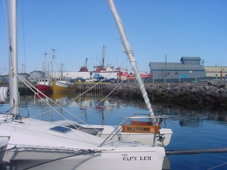
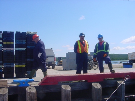
The CAP’N LEM is tied to the wharf at the Cartwright Cannery. The workers take their break looking down and chatting with me. I tell my story, where I came from, where I’m going, how far, how long and the why of it. I try to tell it each time as though it were the first, with all the joy and enthusiasm I can put into it. No matter what I’m doing I stop and I talk to them. I answer the same questions over and over always remembering they are new to them. This is their home and I am the guest. I owe them my enthusiasm. It is the way I have of taking them with me.

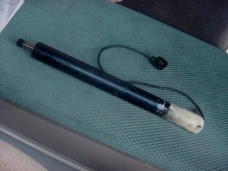
Oh, but the waiting! Waiting when every cell in my body longs to be moving is so hard! No mail for the CAPN LEM today, July 30, 2009. I could hear the plane come in yesterday, then the wait. It takes time to get the mail from the airstrip to the post office, time to sort the mail, time to check the mail. Maybe tomorrow. But tomorrow became today and still no package so I do it all over again and wait.

It is now my own words must come back to me. I must deal with what is, not what I wished, not what I want, not what I like but what is. I must have the part and I must wait to get it. It’s as simple as that. To go on without it now that I have broken my autopilot a second time would be to trust in luck and I have no tolerance for luck. Luck would let me down and the third time it breaks I would not be able to fix it no matter how much epoxy I slather on it.
tiller
No, I’ll just wait. My only defenses against the agony of waiting… get busy. I clean down below. I check my food stocks. I fill up with water. I read. I write letters and I talk to anyone who looks over the edge of the dock.

Questions:

Dick asks: Is there any more anchorages or little towns as I go north? There are. I have to find my anchorages based on where I am and the topography of the land and islands. If I have to hove to overnight and drift it’s ok. The settlements are getting fewer and fewer. When I leave Cartwright I need to have everything to see me through. I do hope to pull into Resolute. Should the ice not let me through I must think about leaving the CAP’N LEM and try completing the voyage next year, but that is all future challenges. Right now, it’s get my part and get going north again.

[Update: Tommy just called and the tiller arrived on the afternoon mail drop!  He’ll be on his way tomorrow. -Ken]
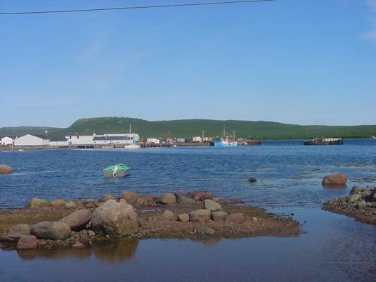
Cartwright

Wednesday, July 29th, 2009

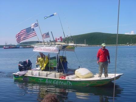
cartwrightI’ve arrived in Cartwright Labrador. I’m waiting on mail and a new autopilot having broken the old one twice now. I keep meeting the most interesting people. George and his wife Pete of Experience Labrador have been so kind in helping me get supplies and my mail. They are adventure magnates! It was there I met a couple out to drive around the world and two brothers set on crossing the Atlantic in a small power boat.

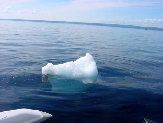
Yesterday I plucked 10,000 year old Greenland glacier ice from the sea for my cooler, again. This time I used the netting between the hull and the ama to corral a piece then proceeded to chop it up into manageable bits for the cooler. Ah, one less things to buy. Yes, it was singing its way into oblivion. Well, not really oblivion but a new life as salty seawater. Perhaps the sea is heaven to fresh water since it is always working its way there.

We talked of polar bears and how they have been seen this far south. I was reassured if I would leave them alone they would leave me alone. No worries there, I tell ya. I’ve seen polar bears in the wild and have no need or desire to see one close up.

My science officer, Wayne Roberts, has started feeding me ice information.

Unstranger asks about the term “in irons”: A sailor is said to be “placed in irons” when he has been taken below and locked to a bulkhead with chains or leg irons. So the term was used to descript a ship that fails to make the turn through a tack into the wind, comes to a stop and starts to actually sail backward. The same thing happens to a sailboat if the tack is not executed just right and results in lost time and ground. In a high wind it can be difficult to get going again in the right direction.

The question has come up again about the radar picking up icebergs. My Furuno really does a good job of picking them up but does not do so good picking up the bergybits that fall from the bergs. These are the ones I have to be very careful about as they are as hard as rocks.

If you think the CAP’T LEM is small check out www.CrossTheAtlantic.com , I can only let these guys, Ralf and Bob, speak for themselves. They passed me when I was anchored at the Indian Tickle. Then, I met them through George at Experience Labrador where we had a great time sharing adventures.

crosstheatlantic

Sings

Monday, July 27th, 2009

I’m not traveling at night as long as there are anchorages to be found. So tonight I’m anchored just north of Indian Tickle at latitude 53⁰ 34′ 01.2″N ~ Longitude 055⁰ 59′ 34.9″W.

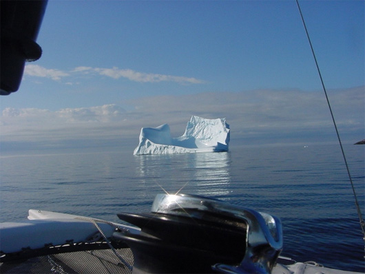
It’s the icebergs or rather, the tears of the icebergs, the bergybits, I must avoid in the dark. All around the ancient giants that have drifted from Greenland to die grounded on the shores of Labrador are tears of diamond. This is not your last winter’s sea ice all soft and salty but ten thousand year old snowflakes pressured to perfection in ice, clear, clean, some the size of a car, easy to see, some the size of a dinner table, not so easy to see, but each as hard as any rock on shore and just as dangerous. They command respect and I give it.

When I have reason though, I sneak up on one very carefully to retrieve ice for my coolers. And it was while doing just that I discovered the most amazing thing about a bergybit…it sings! They sing as they die in the salty swell. It’s the sound of crystal glass being broken in the fireplace after a toast, but no quite. It’s a sound like the bubbles in a bubble bath popping, but not quite. It was the sound of the fizz of a soda pop, but… well, you get the picture. And I only had to touch it with my knife point for it to yield all the ice I needed.

What will I learn next?

Oh I must tell you this also. I saw my first Right Whales today. One alone and three in a pod.

iceberg3

Labrador

Sunday, July 26th, 2009

The CAP’N LEM is in Labrador. Belle Isle is lost on the southern horizon haze. We’re rarely out of the sight of an iceberg. Getting underway this morning from my tranquil anchorage where never a rock of the boat woke me in the night, we picked our way around and out first the Miller Tickle and then the very narrow Antelope Tickle. How could I resist taking the CAP’N LEM thru a passage named Antelope Tickle?

I see on the large scale charts showing many of the small narrow passages are called “Tickles”. It must refer to the way the tide current ripples through. Captain Le mould have loved that, he being one always quick for a play on words.

So out we go into a gentle rolling North Atlantic swell. Our morning dolphins display their speed winning the race, no contest. In the distance I see a great moving shoal like I’ve never seen before. As we draw closer it becomes a mass of tightly packed sea birds all moving together. Closer still and they take flight almost as closely packed as they swam. I don’t know what they were but they were wonderful. The morning whale comes to the surface to greet us with a blow and that signals the end of the GOODMORNING CAP’T LEM show. Nature draws the curtain with a white fog over all while preparing the next act.

The fog is dense in width and shallow in height. A warm sun makes its way to my shoulders and is welcome. I never curse the fog but rather just deal with it. This time the fog brings a Southeast wind and the wind is energy. The wind turns the whole world underneath the CAP’N LEM.

At 1410, the odometer on the GPS shows we have traveled 3000 nautical miles since leaving Two Harbors Minnesota on April 6th. I don’t torture myself with how far I have to go.

Sunset and I find a little cove near Ship Tickle Island at Lat 52⁰ 43′ 53.2″N ~ Long 055⁰ 49′ 46.3″W. It’s a small fishing village.

So ends this day.

iceberg2

John asks: What have you done to prepare should a polar bear get on board?

Well, first, I’m more apt to be eaten by mosquitoes than a polar bear. I thought I could just feed him cookies and hope he gets full before I run out of cookies, but a handheld signal flare would be my first choice. No firearms on board. The customs guys would have eaten me.

Experience Labrador

Sunday, July 26th, 2009

– Ken here. Big thanks to George Barrett of Experience Labrador Tours. Tommy’s autotiller is working just fine – Tommy is a wizard with Epoxy – but just to be safe he decided he’d like a spare. Found one in stock here in Seattle and Express mailed it July 22nd, all the way to Cartwright, Labrador. George kindly offered his services delivering it to the marina there in Cartwright. Should get there middle of this week if all goes well.

No day finer

Saturday, July 25th, 2009

July 24, 2009: No day finer than this one. Were every day on the sea such as this and every wind on the quarter; cool but not cold, warm but not hot, the sun bright, the horizon clear, why the whole world would live on the water.

But change is inevitable and change on the water comes quickly. The wind dies, then comes up from the Northeast. Not hard though, not enough to kick up a sea so I manage to make it to Winter Cove near Anchor bay and anchor at Latitude 51⁰ 13’ 08” N ~ Longitude056⁰ 45’ 52” W in 19 feet of water just before sunset.

Another night of sleeping straight through, oh, how solo sailing makes such simple things the greatest of pleasures.

July 25, 2009: Underway to catch the outgoing tide, and the promise of another exceptional day. A whale breaks the surface just of the port quarter. I haven’t missed a day seeing a whale while I’m underwaysince my incounter with the white whales. My city at sea is populated by whales and dolphins and seabirds of every kind.

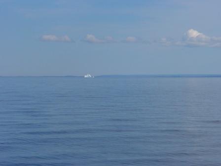
At 1150, way off on the horizon, I see my first iceberg. A moment later, there are two.

2230 The CAP’N LEM is in Labrador now, anchored at position 51⁰ 58’ 50.7”N ~ 055⁰ 54’ 09.8”W.

iceberg

Port Saunders and Port au Choix

Thursday, July 23rd, 2009

Having been blown off course through the night I arrived off the coast of Newfoundland 23 miles south of the latitude I left the Quebec shore side on. See what I mean about Latitude 50⁰ not wanting to let me go. But by noon thirty, Newfoundland time, I reached Port Saunders. It was ever thing you would expect from a Newfoundland fishing village, lighthouse at the entrance, lobster pots on the docks and some wonderful, helpful, English speaking people and free moorage at the boat launch.

port-saunders-newfoundland

It was there that I met NaDine and Rob Hinks running the boat yard. After talking about the CAP’N LEM, they both caught the Arcticsolosail vision, and then just couldn’t do enough to help me. After work, they took me grocery shopping, to get propane, and to get odds and ends for the boat. Afterwards Rob gave me the VIP tour of the most wonderful little town of Port au Choix, including a trip out to Pointe Riche Lighthouse. I loved his stories of local and family history in and around the area. Then, we found an even deeper common ground than boats… video games! What fun we had matching games we’d both played and the “ya gotta play…” games.

What a welcome night’s sleep after a 60 mile crossing in the dark of last night?

Answers

Thursday, July 23rd, 2009

newfoundland-sunsetMy GPS position at 1211 on July 22, 2009 was Lat. 50⁰ 22’ 34’’N ~ Long. 059⁰ 09’ 51”W (remember to retard the longitude for my course and speed at the time of noon 090T @ 5kts
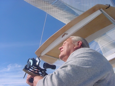
I hope at lease a few of you had fun with the numbers. I’m sure it was Greek to most but thanks for letting me have some fun. I’ve always enjoyed celistual navigation but wouldn’t want to be relying on it solely on this trip. Yes chart plotters and GPS and AIS and radar and caluclators have all made a mental weakling out of me, but I still like to take the sextant out for a spin.

To those who have sent e-mail asking questions about the trip, I’m sorry I can’t respond directly so here are some questions and my answer.

Barb asks: Will the radar pickup icebergs?

Yes, if they are large. Small burgybits will most likely not show up. I’ll hove to at night in ice areas rather than risk an out and out collision.

Roger asks: What do I do about replenishing food onboard?

I have a well stocked pantry of canned goods, soups, sardines, chili, etc. I have lots of crackers, peanut butter, beef jerky, dried fruit and vitamins. When I can and as long as I can I buy my food from local stores. People have been so wonderful to give me rides.

To find your latitude at noon from the sun, take the height observed subtract it from 90⁰ then subtract the declination of the sun at the moment it reached its highest arc in the sky and subtract it if it is a north declination or add it if it is a south declination. By determining when local apparent noon occurred, then the longitude becomes the GHA (Greenwich Hour Angle) of the sun corrected for minutes and seconds. These numbers and the corrections for the height of eye, refraction, upper or lower limb shot, etc., are found in the Nautical Almanac.

Moored in Port Saunders Newfoundland

Thursday, July 23rd, 2009

2000 moored in Port Saunders Newfoundland

Lat. 50 38′ 45.8″N  Lon 057 16′ 18.9″W

Will change engine oil tomorrow and wind willing get underway toward Labrador.

Have full fuel, propane and food stores.

Numbers

Wednesday, July 22nd, 2009

sunsite2I was out of the sight of land for a while today so I took the noon sight.  You can reduce the numbers down and determine my position at noon if you know the math.  I’ tell you this, it was within a mile and half of the GPS position which is pretty good for celestial navigation.

My DR Latitude were 50⁰ N and 60⁰ W

I shot the lower limb of the sun at the following times and altitudes

11h 59m 49s​59⁰ 32.8’

12h 00m 49​59⁰ 33.7’

12h 01m 40s​59⁰ 33.7’

12h 02m 20s​59⁰ 33.2’

12h 04m 47s​59⁰ 32.9’

I called local apparent noon to be 12h 01m 00s

Meridian passage of the sun was at 12h 06m

The sun’s declination at 1600Z was N20⁰ 09.3’  the d correction was 0.5 for 1 minute = 0.0

The sextant index correction was +1.4’  the dip correction was -1.0’

My course was 090⁰T at 5kts

If you know the math you can find my position at 1201 on 7/22/09

And did you know a total eclipse of the sun occurred today?

Tomorrow I will publish the GPS posit I wrote down