Archive for the ‘Saint Lawrence’ Category

No day finer

Saturday, July 25th, 2009

July 24, 2009: No day finer than this one. Were every day on the sea such as this and every wind on the quarter; cool but not cold, warm but not hot, the sun bright, the horizon clear, why the whole world would live on the water.

But change is inevitable and change on the water comes quickly. The wind dies, then comes up from the Northeast. Not hard though, not enough to kick up a sea so I manage to make it to Winter Cove near Anchor bay and anchor at Latitude 51⁰ 13’ 08” N ~ Longitude056⁰ 45’ 52” W in 19 feet of water just before sunset.

Another night of sleeping straight through, oh, how solo sailing makes such simple things the greatest of pleasures.

July 25, 2009: Underway to catch the outgoing tide, and the promise of another exceptional day. A whale breaks the surface just of the port quarter. I haven’t missed a day seeing a whale while I’m underwaysince my incounter with the white whales. My city at sea is populated by whales and dolphins and seabirds of every kind.

At 1150, way off on the horizon, I see my first iceberg. A moment later, there are two.

2230 The CAP’N LEM is in Labrador now, anchored at position 51⁰ 58’ 50.7”N ~ 055⁰ 54’ 09.8”W.
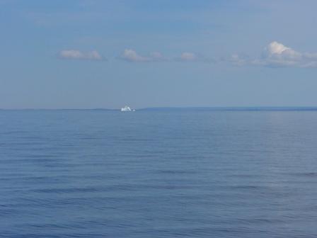
iceberg

Port Saunders and Port au Choix

Thursday, July 23rd, 2009

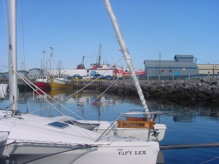
Having been blown off course through the night I arrived off the coast of Newfoundland 23 miles south of the latitude I left the Quebec shore side on. See what I mean about Latitude 50⁰ not wanting to let me go. But by noon thirty, Newfoundland time, I reached Port Saunders. It was ever thing you would expect from a Newfoundland fishing village, lighthouse at the entrance, lobster pots on the docks and some wonderful, helpful, English speaking people and free moorage at the boat launch.

port-saunders-newfoundland

It was there that I met NaDine and Rob Hinks running the boat yard. After talking about the CAP’N LEM, they both caught the Arcticsolosail vision, and then just couldn’t do enough to help me. After work, they took me grocery shopping, to get propane, and to get odds and ends for the boat. Afterwards Rob gave me the VIP tour of the most wonderful little town of Port au Choix, including a trip out to Pointe Riche Lighthouse. I loved his stories of local and family history in and around the area. Then, we found an even deeper common ground than boats… video games! What fun we had matching games we’d both played and the “ya gotta play…” games.

What a welcome night’s sleep after a 60 mile crossing in the dark of last night?

Answers

Thursday, July 23rd, 2009

newfoundland-sunsetMy GPS position at 1211 on July 22, 2009 was Lat. 50⁰ 22’ 34’’N ~ Long. 059⁰ 09’ 51”W (remember to retard the longitude for my course and speed at the time of noon 090T @ 5kts
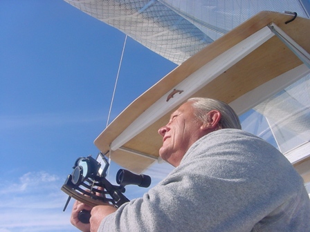
I hope at lease a few of you had fun with the numbers. I’m sure it was Greek to most but thanks for letting me have some fun. I’ve always enjoyed celistual navigation but wouldn’t want to be relying on it solely on this trip. Yes chart plotters and GPS and AIS and radar and caluclators have all made a mental weakling out of me, but I still like to take the sextant out for a spin.

To those who have sent e-mail asking questions about the trip, I’m sorry I can’t respond directly so here are some questions and my answer.

Barb asks: Will the radar pickup icebergs?

Yes, if they are large. Small burgybits will most likely not show up. I’ll hove to at night in ice areas rather than risk an out and out collision.

Roger asks: What do I do about replenishing food onboard?

I have a well stocked pantry of canned goods, soups, sardines, chili, etc. I have lots of crackers, peanut butter, beef jerky, dried fruit and vitamins. When I can and as long as I can I buy my food from local stores. People have been so wonderful to give me rides.

To find your latitude at noon from the sun, take the height observed subtract it from 90⁰ then subtract the declination of the sun at the moment it reached its highest arc in the sky and subtract it if it is a north declination or add it if it is a south declination. By determining when local apparent noon occurred, then the longitude becomes the GHA (Greenwich Hour Angle) of the sun corrected for minutes and seconds. These numbers and the corrections for the height of eye, refraction, upper or lower limb shot, etc., are found in the Nautical Almanac.

Moored in Port Saunders Newfoundland

Thursday, July 23rd, 2009

2000 moored in Port Saunders Newfoundland

Lat. 50 38′ 45.8″N  Lon 057 16′ 18.9″W

Will change engine oil tomorrow and wind willing get underway toward Labrador.

Have full fuel, propane and food stores.

Numbers

Wednesday, July 22nd, 2009

sunsite2I was out of the sight of land for a while today so I took the noon sight.  You can reduce the numbers down and determine my position at noon if you know the math.  I’ tell you this, it was within a mile and half of the GPS position which is pretty good for celestial navigation.
My DR Latitude were 50⁰ N and 60⁰ W

I shot the lower limb of the sun at the following times and altitudes

11h 59m 49s​59⁰ 32.8’

12h 00m 49​59⁰ 33.7’

12h 01m 40s​59⁰ 33.7’

12h 02m 20s​59⁰ 33.2’

12h 04m 47s​59⁰ 32.9’

I called local apparent noon to be 12h 01m 00s

Meridian passage of the sun was at 12h 06m

The sun’s declination at 1600Z was N20⁰ 09.3’  the d correction was 0.5 for 1 minute = 0.0

The sextant index correction was +1.4’  the dip correction was -1.0’

My course was 090⁰T at 5kts

If you know the math you can find my position at 1201 on 7/22/09

And did you know a total eclipse of the sun occurred today?

Tomorrow I will publish the GPS posit I wrote down

Latitude 50

Tuesday, July 21st, 2009

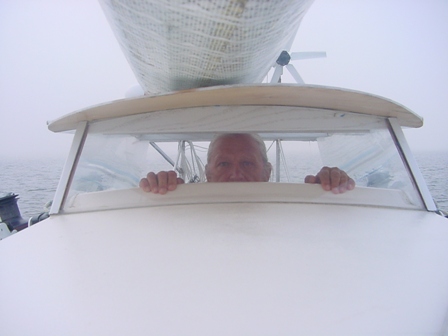
killroy-was-here-smallAnother fitful night of waking, watching, dosing has brought us to Cape Whittle. This is important because I can now turn Northeast and head toward the Strait of Belle Isle and the open ocean. But 50⁰ North is a jealous latitude and has held the CAP’T LEM close to the line for the last 290 miles. A Northeast wind and dense fog conspire to see escape to the north is difficult at best. My hope was the day star could bring the stout and steady west wind of yesterday as it warms the land over Newfoundland but no, it only brought a stronger Nor’easter and more fog.
But, of course, all the wishing in the world cannot change one breath of wind. I’ll just deal with it by climbing out of “Golfe du Saint-Laurent” like a toddler climbs stairs one tack at a time. My job as captain of THE CAPTAIN is to be ready, just be ready. Wind does change.

The fog that came with the wind only sharpens my hunger to see the horizon. I passed two ships at less than three miles, big ships by the size of the radar return, but saw nor heard either one. When I step below I can’t stay for long or the need to look out borders on obsession. The radar, the chart plotter, the AIS all tell me, nothing there, but still the need to see… I want to see that nothing is there. I can only imagine the horror the fog brought to sailors of old.

So I stand in the companion way on the lower rung my head just clearing the hatch cover in such a way that were you the mast looking back you would only see from my nose up. I clasp the hatch combing with both hands, fingers and thumb as though peering over a fence. “Killroy was here!” should be scrawled just below.

By 1500, I’ve had enough of stair climbing and sheet white fog, so I make my way to another anchorage below an abandon lighthouse at Lat 50⁰ 18’ 11.2”W ~ Long. 059⁰ 39’ 43.9”W having traveled 230 nm from Anticosti Island. I’ll sleep the whole night through…unless the wind changes or the anchor drags or the boat rocks…

A wind worth waiting for

Monday, July 20th, 2009

Another night underway waking up, getting up, looking around, resetting the alarm. All is ok as long as I’m making less than 4 knots. In the clear night, I can see 4 times that far and I’m the only light not on shore. CAP’T LEM made 24 miles this way before the dawn broke bringing with it wind speed I don’t want to sleep through. This morning, it’s the wind I’ve been waiting for.

First, it’s 6 knots we jump to, then 8, then 10 and I don’t want to sail 10 knots downwind in a building sea. I much prefer a steady 6, so it’s out to douse the headsail and shorten the main. I let the CAP’T LEM go into irons to relieve the pressure on the main as I bring it in one roll of the boom at a time. It makes me glad I practiced sailing her out of irons back on the lake now that the seas have built 6 to 8 feet.

Oh, but it’s from the right direction! It’s from the west and I want to go east and there is nothing ahead for a hundred miles but water so I press on. By noon the waves are taller the me standing upright in the cockpit and coming faster than my 8 knots. The course I’ve set takes the wind a few points on the port quarter. The boom is down tight and the traveler is secured. I stay ever mindful of a jibe. My motorcycle helmet is kept at the ready should I need to go out on deck to deal with a wild boom, but for now she’s tame.

The waves come up behind and lift the stern. The speed accelerates. It rolls under amidships where it crest in a fizz like a shook-up soda pop, then drops the stern and raises the bow giving the vessel a hobbyhorse ride. And they do it over and over and over. It’s just what waves do.

It looks as though the wind will turn on me one more time before I’m free and clear to head north along the coast of Labrador. But for now I am making glorious head way with beautiful clear skies over all.

My position at 2000 on the 20th of July is Lat. 50° 05’ 04’’N ~ Lon. 061° 00’ 17” W. I’m sailing 6.6 kts under a reefed main alone in a 20 knot wind. The sun has set. It’s going to be along night.

Underway again

Sunday, July 19th, 2009

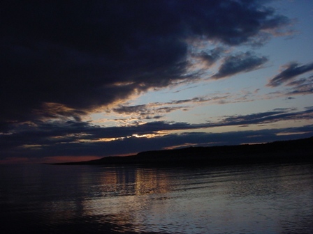
The sun is setting on “Detroit de Jacques Cartier”, The Strait of Jacques Cartier. The CAP’N LEM sailed with the changing wind after weathering a southeaster in Port Menier on Anticosti Island. There is still a high wind watch but it is from the right direction to push us along or way.

We sailed through a pod of minke whale ten or twelve strong. It must have been a feeding ground because there were dolphins there too.

The weather tonight looks fine to sail on through the night. At 2000 the CAP’N LEM’s position was Lat. 50° 08’ 26’’N ~ Lon. 064° 08’ 27”W. I’m glad to have the numbers back above 50°.

I’ve broke the autopilot again. I have to go onto the stern to raise and lower the motor, and while I was back there I slipped just enough to fall against the disengaged autopilot and broke the pivot pin lose. Nothing a generous helping of epoxy could fix. “She ain’t purdy, but she’s a workin’.” Such is life on a solo sail.

To all who have e-mailed me, thank you so much! I’m sorry but I can’t answer them now. I can only receive them. I do read them all.

Anticosti Island

Saturday, July 18th, 2009

Daybreak brought a gentle wind…dead on the nose. Time for a change in tack. I had hoped for one more day of fair wind and following seas but it was not to be. There are two Straits between me and the Atlantic Ocean, The Strait of Jacques Cartier and the Strait of Belle Isle. I want a fair wind. I need a fair wind. But sometime I get neither what I want nor what I need.

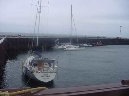
Now there is a gale blowing across the north of Anticosti Island and of course from due east. I take a page for the “Captain Lem’s Verbal Handbook” and run-hide at Latitude 49° 48’ 44” ~ Longitude 064° 21’51”. From what I can tell of the chart plotter, it’s called Port Menier just inside of Cape Henri. The holding ground is lousy. I was blown out of my anchorage twice before giving up and coming in to moor in the barge basin. There is one other sail boat tied up in here doing the same thing. Kelp was the problem. It tangles with the flukes and does not let them bite.

Captain Lem was a hurricane fighter. This little blow in nothing like he would battle just about every year the last 20 years of his life. It seemed as if every hurricane that came up the east coast came looking for him, but he had his “hurricane holes”, places where he would take the TONI AND DONNA and just wait them out.

I remember him telling me about Hurricane Floyd. It came ashore around Georgia or South Carolina, I don’t remember all the details, and then turned to head back out to sea across North Carolina right where Captain Lem was hiding. Captain Lem was all anchored down in his hole when the eye of the thing went right over him. But Ol’ Floyd was a strange one because when it didn’t get him the first time, it went out to sea, stopped, revved up, reversed course and came back ashore for a second try at him. The eye passed right over the top of him again. Then, when it didn’t get him a second time, it reversed course again and went for him a third. The Cap told me he was getting pretty tired of Floyd by then so right in the middle of the third pass Captain Lem went out on deck, looked Floyd in the “eye” and shook his fist. Well, that was all Floyd could take, so he huffed and puffed and blew all the water out of the bay so the TONI AND DONNA just sat on the bottom as stable as a rock while Ol’ Floyd moved out to sea again and by the time the water came back into the bay, Floyd had blew himself into a nice summer breeze. Then the Cap said this, “Every hurricane has an eye, but they don’t see worth a dang.”

Well anyways, that’s the way I remember Captain Lem telling it.

harbor-2

Open Water

Friday, July 17th, 2009

The CAP’N LEM is clear of the Saint Lawrence River and is well into the Gulf of Saint Lawrence. They must have thought a lot of Saint Lawrence to have names such grand bodies of water after him.

I miss the interesting detail of the river bank and the islands. I miss the comfort of a safe anchorage with a good muddy bottom to hold the CAP’N LEM put. But it’s good to be in open water, water with waves and swells and unbent wind. Things change on the open water. The stress of many boats and few mariners is gone. Those out here are sailors whether motor, steam or sail. They have a reason for being here and that makes them easier to deal with, much less unpredictable.

Open water gives the mind freedom to roam the past, the present and the future. It gives the body so measure of freedom too. With fifteen miles of view all around it’s acceptable to go below to cook, clean or just tinker. I prefer tinkering. I put extra lashings on the trampoline. I made some new preventers using Cunningham hooks. Very useful in holding down the sails and boom to reduce chafe in the new added motions from the swells. I can read or write. I can even dose if I remember to set my alarm so as to not over do it. Something inside just won’t let me take my eyes of the horizon for very long. I search the horizon, check the radar and AIS for any hints of company and note my position on the chart. I’m right now seven miles off shore on a parallel course and making 2.5 knots. It would take me hours of being on the wrong heading to run aground, so that’s not a problem.

This longing to look is a leftover habit of many many sea watches. I loved getting a new ensign fresh out of the academy, to break in on watch on the POLAR SEA or the POLAR STAR. With binoculars around my neck I would jester out the windows and say something like this. “Your business is out there. Look at the radar, look at the chart, look up, look down but never forget to …look out! That’s your business. Out there. Best the Captain see the back of your head ‘stead of your smiling young face when he comes through that bridge door. It is your watch.” Later, when they were getting it, I would add this, quieter, for emphases, “Never. Never let the terrible weight of responsibility slip from your shoulders for even a moment of your watch.”

Now those days are gone. I only have myself to tell. “Never let the terrible weight of responsibility slip…” It’s my watch and this time my watch is endless.

My July 16, 2009 position report: Lat 50° 07’ 40”N ~ Lon 065° 43’ 36”W. WX wind w 4kts, swell sw at 4’

Partly cloudy with distant cumulous. C- 090T S-2kts